

Quick answer
A knuckles mountain range day hike typically takes five to eight hours, depending on the trail you select and your pace. The conservation forest is open from 07:00 to 17:30 every day, and entrance permits cost 2,500 LKR per person. Arrive before 10:00 to avoid the afternoon cloud cover that obscures ridge views and makes navigation harder.
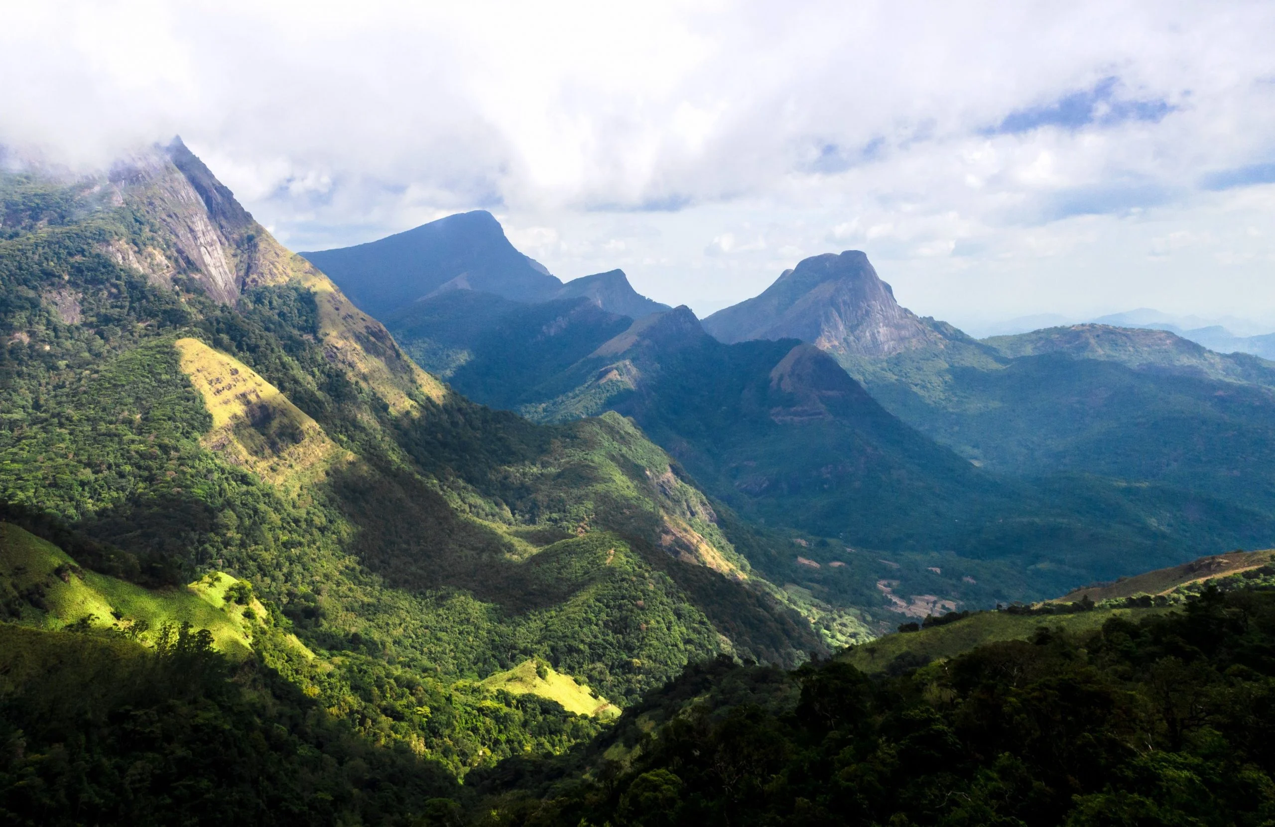
The Knuckles range earned its name from five ridges that resemble a clenched fist when viewed from the Matale district, and those same folds create a labyrinth of microclimates where montane cloud forest meets grassland plateau within a single morning's walk. A knuckles mountain range day hike demands more preparation than most Sri Lankan treks because the terrain shifts rapidly and trail markers can be sparse once you leave the main arteries. The most accessible routes start at Corbett's Gap, where a dirt track ends at 1,300 meters and the Nitro Caves trail or the Mini World's End loop begin. Both can be completed in five to six hours at a moderate pace, though the latter includes exposed ridgeline sections where footing becomes precarious after rain. The longer Ash Cave or Sera Ella waterfall routes add two to three hours and require a local guide, not for navigation alone but because certain sections cross private tea estates where informal permissions matter. The conservation permit is your legal clearance, but it does not grant automatic passage through every trailhead. What separates this range from gentler hill-country walks is elevation change compressed into short distance. A typical day route climbs 400 to 700 vertical meters, often over root-tangled paths and loose shale, and the descents are steep enough that trekking poles earn their weight. Leeches are active year-round in the lower forest zones, particularly between May and September when the southwest monsoon saturates the undergrowth. Closed-toe boots and leech socks are not optional. The ridgeline grasslands above 1,600 meters dry out between January and March, but that same period brings the clearest skies for panoramic views across the Central Highlands. Cell coverage disappears beyond the trailheads, and the forest office at Deanston or the ranger post at Riverston are your last points for updated trail conditions. Weather shifts quickly here: mornings can be warm and clear at 07:00, then by noon clouds settle into the valleys and reduce visibility to twenty meters. That narrow arrival window between 07:00 and 10:00 is not arbitrary; it ensures you summit or reach your turnaround point before the afternoon mist makes route-finding guesswork. Most hikers underestimate how long the return leg takes once fatigue sets in and the light begins to drop. The forest gate closes at 17:30, and rangers will not extend that for late arrivals.
“The Knuckles range compresses 700 vertical meters into a morning's walk, and the descents are steep enough that trekking poles earn their weight.”
Best Time of Day and Season for a Knuckles Mountain Range Day Hike
The optimal window for a Knuckles Mountain Range day hike occurs during the dry season months when visibility is highest. Hikers should aim for the best arrival window: 07:00–10:00 to maximize clear morning views before afternoon mist develops.
January to March
LowCool and dry, 15°C to 20°C
Ideal conditions for trekking with minimal rain and high visibility.
June to August
ModerateWarm and windy, 18°C to 24°C
Drier period, though high winds are common on exposed mountain ridges.
September to October
LowMild, 16°C to 22°C
Often clear weather, providing good opportunities for summit views.
Weekday mornings
Minimal—
Reduced trail traffic allows for a quieter experience and clearer early visibility.
Verdict: Plan your visit between January and March, arriving during the 07:00–10:00 window to ensure the clearest weather for your hike.
Operating Hours for Knuckles Mountain Range Day Hike
The Knuckles Conservation Forest is open daily for visitors throughout the week, maintaining a consistent schedule for day hikes.
| Monday | 07:00–17:30 | |
|---|---|---|
| Tuesday | 07:00–17:30 | |
| Wednesday | 07:00–17:30 | |
| Thursday | 07:00–17:30 | |
| Friday | 07:00–17:30 | |
| Saturday | 07:00–17:30 | |
| Sunday | 07:00–17:30 |
Getting to the Knuckles Mountain Range Day Hike Trailheads
The Knuckles Conservation Forest is located in the Central Province of Sri Lanka. Access to the various trailheads typically requires private transportation from major hubs like Kandy or Matale.
A9 Road to Matale via Rattota road
Hire from Kandy city center to forest boundary
Kandy to Wattegama, then transfer to local bus towards Bambarella
Pre-Hike Checklist for Your Knuckles Mountain Range Day Hike
Prepare these essentials before your hike to ensure safety and comfort on the trail.
-
Secure conservation forest permit in advance — Required for legal entry; arrange through local guides or Forest Department.
-
Wear ankle-supporting hiking boots with grip — Trails are steep, rocky, and often muddy, especially after rain.
-
Pack waterproof jacket and layers — Afternoon mist and sudden rain are common; temperatures drop at elevation.
-
Bring 2–3 liters of water per person — No water sources on most trails; hydration is critical in humid conditions.
-
Carry energy-dense snacks and lunch — Limited food options near trailheads; plan for 6–8 hours of activity.
-
Download offline maps of your chosen route — Mobile signal is unreliable; GPS-enabled maps prevent navigation errors.
-
Apply sunscreen and insect repellent — Exposed ridges offer little shade; leeches are present in wet season.
Check availability
Frequently asked questions about knuckles mountain range day hike
Everything you need to know about knuckles mountain range day hike